


The New England High Country is part of the boundary between the World Heritage listed Gondwana Rainforests of the East Coast and the dry tablelands of the New England North West; encompassing some 500km of rivers and gorges, as well as wilderness areas covering over 300 square kilometres, there are a number of National Parks and areas of interest within the region. Many of these parks are within a 100km radius of Armidale Tourist Park, making the park an ideal base for a long weekend of exploring. Significant areas include:
Ebor Falls:Watch the Guy Fawkes River plunging 100m over two waterfalls at Ebor Falls. Three lookout platforms along the edge of the gorge – upper falls, lower falls and valley view — give spectacular views out into the rugged gorge country.
Dangars Falls: A perfect bush spot for a family picnic, the Dangars Falls area offers scenic waterfall and river views on the Northern Tablelands near Armidale.
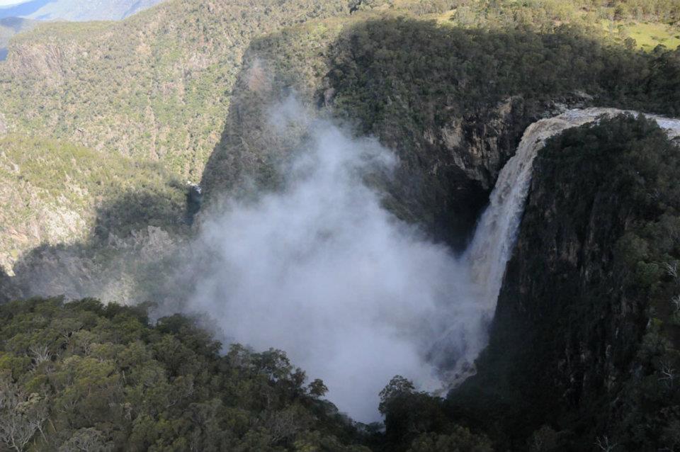
Wollomomboi Falls: With a drop of over 200m, these falls are some of the highest in NSW. With a number of walking tracks around the area, there are some fantastic vantage points at the top of the falls looking down into the gorge below (and further downstream)

Point Lookout and Cathedral Rock: these are some of the highest points in the area (that are publicly accessible) with commanding views out over the Cunnawarra Wilderness area towards Port Macquarie, Coffs Harbour and the Dorrigo Plateau. Cathedral Rock is a half day walk to the summit (including a challenging scramble up the rocks to the top) whilst Point Lookout has walks ranging from 500m on sealed paths through to all day walks through dry rainforest that is part of the Gondwana World Heritage area.
Gara Gorge and The Blue hole waterfalls: Gara Gorge was the site of one of the earliest hydroelectric power schemes in the 1800’s that was intended to power Hillgrove. Gara Gorge has a 6km circular walk that will take you along the route of the hydroelectric scheme with some fantastic views out into gorge country. Alternatively, a good hot day activity is to rock hop along the river bed on the large granite boulders that make up the river bed.
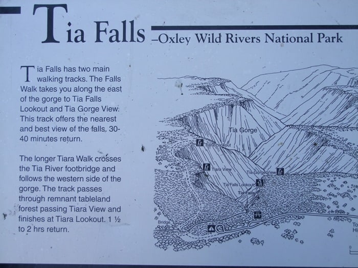
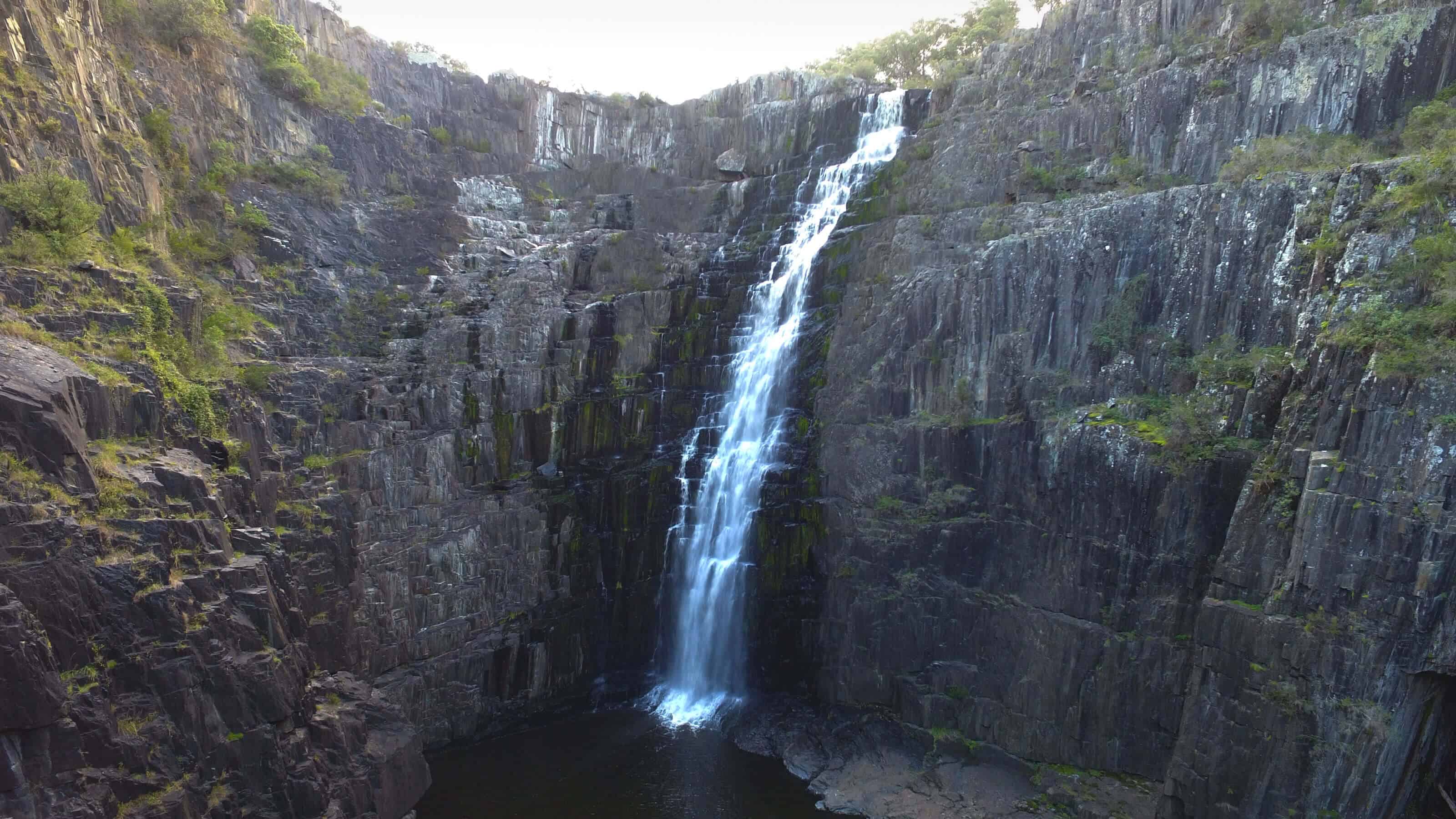
Tia Falls: A picturesque picnic spot, just off Oxley Highway, makes Tia Falls an ideal stop over on a long drive. Located on the south western edge of Oxley Wild Rivers National Park, it’s a great introduction to the rugged wilderness of the gorge country. The kids will love the waterfall, especially after big rains, which is when you might see rainbows.
Apsley Falls: Apsley Falls is perched on the edge of the Great Escarpment, with impressive views of upper Apsley Gorge. It’s just off the Oxley Highway, making it an ideal pit stop on a road trip.
There are also a variety of back roads that can be taken to link places together, often well maintained dirt roads, which can give sneak peeks into other areas of interest:
- Metz Gorge: Metz is accessed from the Waterfall Way, and is closely linked to Hillgrove. From Chinaman’s Gully Road, there is viewpoint into the back of Hillgrove looking out over Bakers Creek.
- Bakers Creek Falls: Accessed either via the Old Hillgrove Road, or via Metz and Chinaman’s Gully, these falls are hidden away from the main road and are much smaller than the surrounding falls
- To the north of Waterfall Way there is an alternative route back via Kilcoy Road and Chandler Road that will bring you back into North Armidale; this road runs through a number of stations that would historically been sheep properties, but are often now cattle.
More information can be found at the following websites:
Waterfall Watching
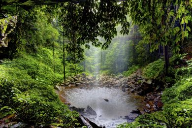
The New England area is renowned for it’s waterfalls with a number dotted around the area. Many of these falls however, only flow seasonally and often very localised rainfall is needed to provide enough water to get them flowing.
Using feeds from the Bureau of Meteorology it is possible to give some indication as to river levels; at the moment we are still working out at what levels the falls will be running, so please check back for updates.
We have water level information for the following falls in the local area:
- Dangars Falls, which is 21km from Armidale Tourist Park
- Wollomomboi Falls, which is 38km from Armidale Tourist Park
- Ebor Falls, which is 77km from Armidale Tourist Park
- Apsley Falls, which is 85km from Armidale Tourist Park

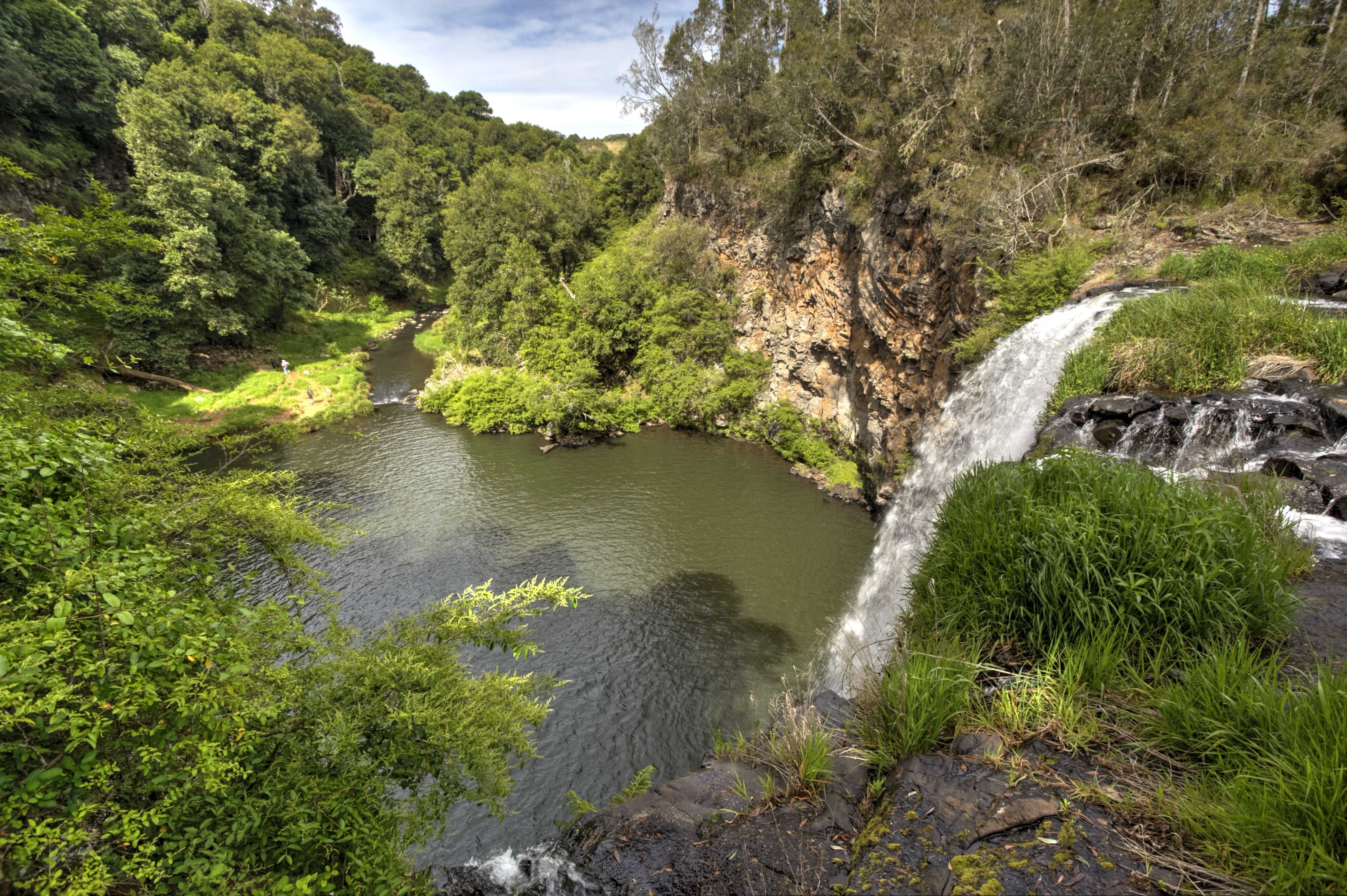
Dangars Falls, located on Tourist Drive 19, are nearest to Armidale Tourist Park. Consisting of a single drop to a pool below, these falls are very accessible with sealed paths and no steps to many of the view points. The path on the car park side of the river is fully fenced, however, if you cross the bridge (only passable in low water) the path is not fenced and unmade.
River Levels that ensure water flowing over:
At m the Falls will be running
Above 2.5m the bridge over the river will be impassable (water flowing over the bridge)

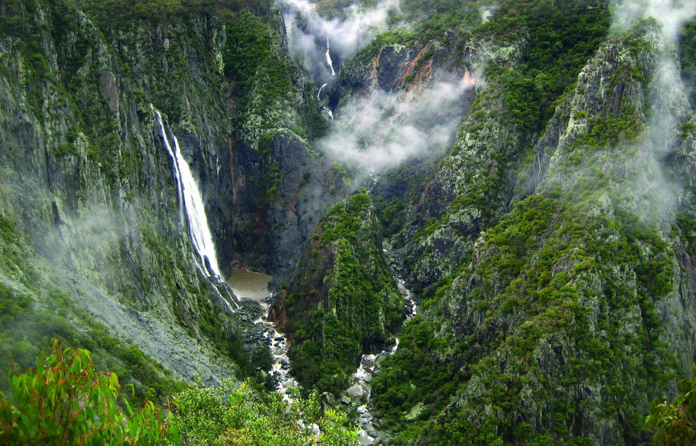
Wollomomboi Falls are located off Waterfall Way, between Armidale and Ebor. The falls are made up of two rivers, the Chandler and the Wollomomboi which converge to form the Chandler River. These falls are some of the highest in NSW, and the Wollomoboi Walking Track takes you above the drops, accessed via unmade and partly fenced paths. Other viewpoints include the Chandler viewpoint, located about 150m down the hill from the carpark with a fully sealed path and fence alongside.
River Levels that ensure water flowing over:
Above approximately 0.85m the falls will flow

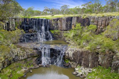
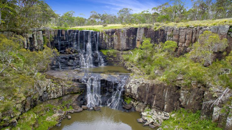
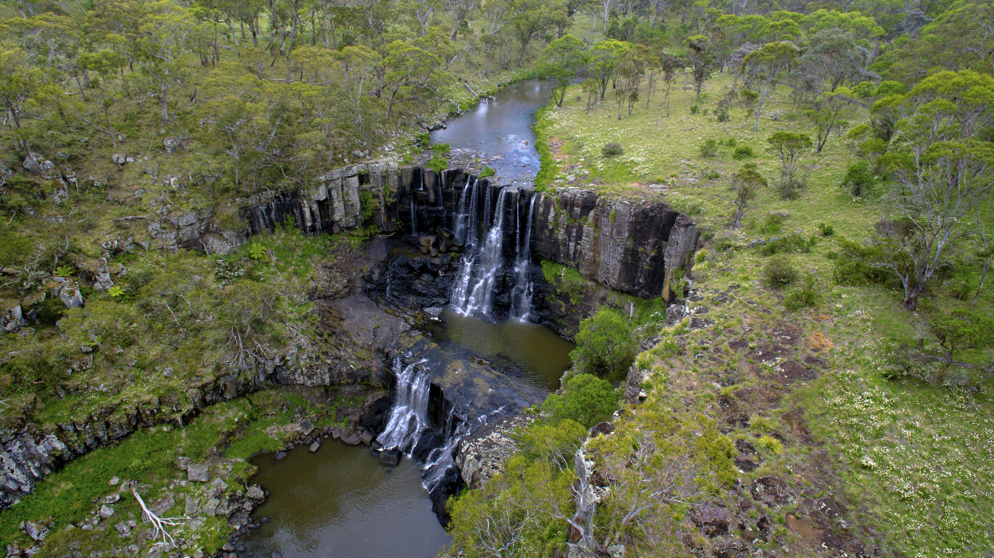
Ebor Falls are located just off Tourist Drive 17, around 70km from Armidale. Consisting of a pair of falls (the Upper and Lower falls), the river drops over 100m in a short distance. These falls are accessible with sealed paths and no steps to many of the view points. The path alongside the gorge is almost completely fenced.
Ebor Falls are much more reliable than the falls closer to Armidale as the catchment area encompasses areas bordering onto the wet rain forest (compared to the dry rain forest and tablelands that surround Armidale)
