


The Armidale area has a maze of backroads that run through the pastoral properties that dominated the agricultural history of the area, as well as the old logging roads and fire trails that crisscross the Styx State Forest.
Whilst the reputation of the area has spread through the motorbike adventure riding community, it’s still a hidden gem for the 4wd community.
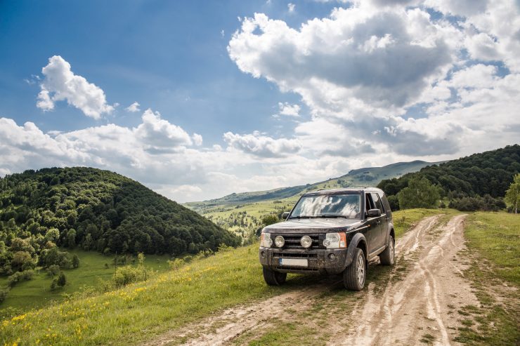
Many of the roads are 2 wheel drive friendly in the dry, just off of those are often trails and tracks that will get you to some fantastic viewpoints that overlook the surrounding state forest and national parks.
Four wheel drive options
Due to the history of the area – the mix of agriculture and forestry – the trails around here are a mix of open roads that connect properties and also forest trails that are used infrequently.
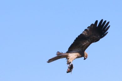
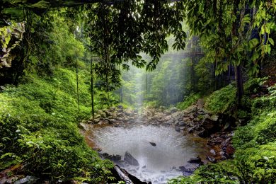
Areas in the Styx State Forest border the national parks giving fantastic views across the dry rainforest that dominates the region, and let you have the feeling of discovery as you head down a little used trail.
Four Wheel Drive Highlights:
A few teasers to wet your appetite – we recommend having a look on the maps mentioned below and using these as areas to consider including in your trip planning:
- Second Gap (on the Kempsey Road) to First Gap, following the power line access trail – this will need a vehicle with low range, and no fear of heights as the trail is only the width of a 4×4 and runs along a ridge line with steep drops off to the side.
- Eely Creek Fire Lookout (off of Loop Road in Styx State Forest)
- George’s Trail (Runs from Forest Way to Bellbrook) – again may need low range as it has a steep descent/climb, and is a dry weather/low water road only due to a river crossing on the way.
Forest Way and Loop road give you access to many different trails that can link other parts together, or give you access to spots on the Styx River.
We recommend looking on the NSW Land and Property Information map (https://maps.six.nsw.gov.au/) and allows you to select Topographic or Street maps by clicking on the Basemap button and zoom in to whatever level you would like. A lot of the tracks have old signage on them, but trying to match them to the maps is a bit of a challenge!
Touring Routes (suitable for most two wheel drives):
We’ve put together some of our favourite drives around the New England High Country that are signposted around the area. Often comprising a mixture of sealed and unsealed roads, please take care when on them.
If you would like any further information on any of these routes, please stop in and speak to us in the office.
Tourist Drive 17: “The best of New England High Country”
This circular route from Armidale Tourist Park – Hillgrove – Ebor – Guyra – Armidale is signposted as Tourist Drive 17; more detailed explanatory notes for the original route are found here.
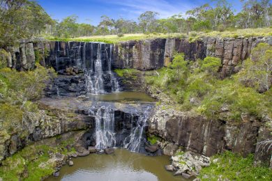
Following this route (or one of the variations) provides access to many of the waterfalls and gorges in the area, such as Bakers Creek, Wollomombi and Ebor.
We’ve added a couple of detours to the signposted route, which now includes Metz, Bakers Creek and the museum in Hillgrove, and the Dutton Trout Hatchery and Point Lookout. There are sections of unsealed roads, on this route they are good council, state forest and national park roads which are regularly maintained.
If you don’t want to come back from Guyra on the New England Highway, we have added a detour along Greenhills Road on this route; Greenhills Road is a good unsealed road that shows off the variety of country that we have in the area:
Continuing on the variations of Tourist Drive 17, we have a shorter version that misses out Ebor and Point Lookout, instead returning via Wollomombi and Thalgarrah to Armidale. The roads between Wollomombi and Rockvale Road run through a number of stations; a contrast to the steep wooded country around the gorges. These roads are once more unsealed, so take care if there has been some rain as there are a number of causeways.
Tourist Drive 19: “Culture, Wilderness and Heritage“
Tourist Drive 19 starts or finishes in Armidale, and provides a pleasant alternative route to Uralla instead of the highway. The explanatory notes for the route are found here.
We’ve added a stop in Uralla so that you can visit the New England Brewery for a taste of their beer and some of the other locally made drinks on offer. Coming back from Uralla to Armidale you will pass Saumarez Homestead, accessed via the airport road, which is a National Trust property open to the public most weekends in Spring, Summer and Autumn. This route has the shortest unsealed section of all the routes, and as with many of the others is a good council road.